|
The available options for plot parameters in Collect survey designer do not fit my needs. I tried to change the parameters in the project_definition.properties file, but when I do this (all I do is change two numbers and save it again) when I try to open in Collect Earth, it gives me the error "project_definition.properties file is not found". The file is definitely there, but the software it not reading it. My question -- how do you change plot size to 6x6 in your Collect Earth file so that it opens correctly from the CEP file (and you don't have to change the parameters manually in the Properties box)? Alternative, how do you update the project_definition file so that Collect Earth can read it properly? (I opened it in Code editor and did nothing to change the name of the file) |
|
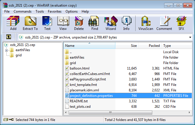
Right now the Collect Survey Designer is limited to a few plot shapes and sizes (we will fix this shortly). In the Collect Earth properties "Plot Layout" tab you have the full range of options that are available for plot designs, including different shapes and even special National Forest Inventory cluster designs. If you want to have a CEP file where the plot layout is pre-selected so that your interpreters do not need to manually choose it in the properties dialog you will need to edit the project_definition.properties file that is within the CEP file. You can access this file by opening the CEP file with an application such as WinZIP or WinRAR. After all a CEP file is just a zipped folder (see image)
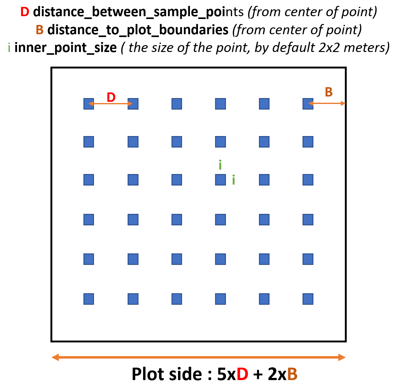
Once you open the file you need to edit the properties that handle the plot layout. In your case if you need to have a 6x6 plot you will have to change these lines : Notice that you set the 6x6 subsampling grid by setting the number_of_sampling_points_in_plot to 36. By the default it is 5x5 (25 points)
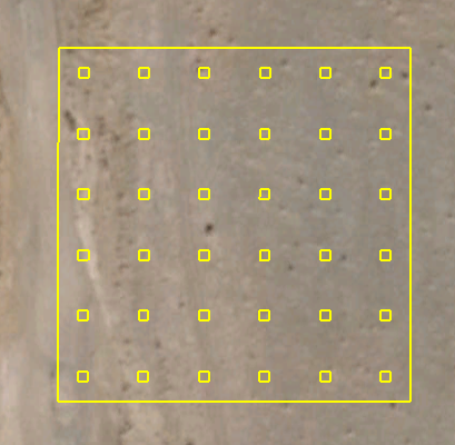
So, if you want to have a half a hectare plot with 36 points you should set it like this Half a hectare = 70 meters side == 5x12 + 2x5 Once you have changed the project_definition.properties file save it and the CEP file should be updated. NOTICE: This process should be done each time that you create a new CEP file from the Survey Designer! When you now double-click on the CEP file the plot layout should look like this
|