Hello,

I have used SEPAL to make a classification of the land use. I would like to export my training points to use them for other purposes in a GIS.

Does anyone have an idea of what I can do?

Thanks in advance

-- Joël Masimo

asked 27 Sep '22, 15:49

jmasimo's gravatar image

jmasimo
113
accept rate: 0%


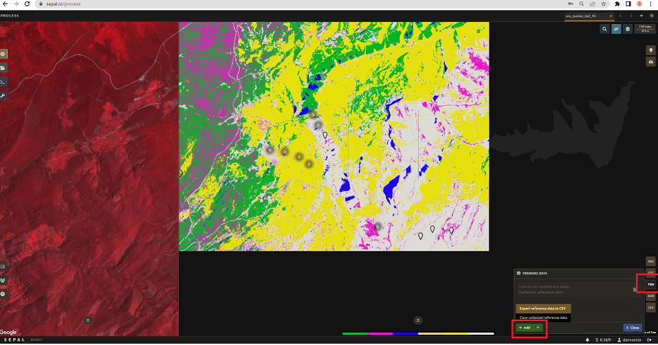
You have an option under the training TAB to do that

alt text

You can export as CSV with the 3 columns "XCoordinate YCoordinate class"

Hope it helps

permanent link

answered 27 Sep '22, 16:23

lecrabe's gravatar image

lecrabe ♦
4163612
accept rate: 6%

Many thanks for this quick answer!

alt text

permanent link

answered 27 Sep '22, 16:51

jmasimo's gravatar image

jmasimo
113
accept rate: 0%

edited 27 Sep '22, 17:54

Your answer
toggle preview

Follow this question

By Email:

Once you sign in you will be able to subscribe for any updates here

By RSS:

Answers

Answers and Comments

Markdown Basics

  • *italic* or _italic_
  • **bold** or __bold__
  • link:[text](http://url.com/ "title")
  • image?![alt text](/path/img.jpg "title")
  • numbered list: 1. Foo 2. Bar
  • to add a line break simply add two spaces to where you would like the new line to be.
  • basic HTML tags are also supported

Question tags:

×27

question asked: 27 Sep '22, 15:49

question was seen: 1,703 times

last updated: 27 Sep '22, 17:54