Dear Collect Earth Team,

I have been using the grid generator, and for the grids that have been generated I have opted to generate additional information pertaining to the DEM data (elevation, aspect, slope) and IPCC data (climate, soil, gez). The csv files list out numerical values for each of these variables for every grid (for example, the soil variable has values ranging from 0 to 8). However, I am unable to locate a code list to interpret the numerical codes for their corresponding value. May I please have assistance in this regard?

Thank you, Mary Ann

asked 20 Jan '22, 19:49

MaryAnnGeorge's gravatar image

MaryAnnGeorge
112
accept rate: 0%


Dear May Ann,

Thanks for your question, let me explain.

The Grid Generator ( LINK ) extracts the IPCC-ready data from rasters (numeric data). Same thing for the elevation, aspect and slope which come from the Google Earth Engine DEM algorithm using the SRTM data.

If you look in the default Land Use survey used in Collect Earth you will find the code lists used and the meaning of these codes.

FAO Global Ecological Zones 2010

GEE asset : users/sanchezpaus/gez_2010_wgs84

Download here: http://www.fao.org/geonetwork/srv/en/resources.get?id=47105&fname=gez2010.zip&access=private - more info http://www.fao.org/docrep/017/ap861e/ap861e00.pdf. ecological zones that are used as the standard classes in the GHG inventory software.

Legend

 value  code    label
41  Ba  Boreal coniferous forest
43  BM  Boreal mountain system
42  Bb  Boreal tundra woodland
50  P   Polar
24  SBWh    Subtropical desert
22  SCs Subtropical dry forest
21  SCf Subtropical humid forest
25  SM  Subtropical mountain system
23  SBSh    Subtropical steppe
32  TeDc    Temperate continental forest
34  TeBWk   Temperate desert
35  TeM Temperate mountain system
31  TeDo    Temperate oceanic forest
33  TeBSk   Temperate steppe
15  TBWh    Tropical desert
13  TAwb    Tropical dry forest
12  TAwa    Tropical moist forest
16  TM  Tropical mountain system
11  TAr Tropical rainforest
14  TBSh    Tropical shrubland
90  Water   Water
0   No data No data

Global Soil Map

GEE asset : users/sanchezpaus/SOIL_TYPE_rst

From the JRC Support to Renewable Energy Directive https://esdac.jrc.ec.europa.eu/projects/RenewableEnergy/

Legend

 value  code    label
 1 ORG Organic
 2 SAN Sandy Soils
 3 WET Wetland Soils  
 4 VOL Volcanic Soils  
 5 SPO Spodic Soils    
 6 HAC High Activity Clay Soils  
 7 LAC Low Activity Clay Soils  
 8 OtherAreas Other Areas  
 0 No Data The map contains no data for this plot

Global Climate Zones

GEE asset : users/sanchezpaus/CLIMATE_ZONE_rst

From the JRC Support to Renewable Energy Directive https://esdac.jrc.ec.europa.eu/projects/RenewableEnergy/

Legend

 value  code    label
 1  WTM     Warm Temperate Moist    
 2  WTD     Warm Temperate Dry  
 3  CTM     Cool Temperate Moist    
 4  CTD     Cool Temperate Dry  
 5  POM     Polar Moist 
 6  POD     Polar Dry   
 7  BOM     Boreal Moist    
 8  BOD     Boreal Dry  
 9  TRMT    Tropical Montane    
 10 TRW     Tropical Wet    
 11 TMM     Tropical Moist  
 12 TRD     Tropical Dry    
 0  NO INFO     NO INFO
permanent link

answered 21 Jan '22, 14:47

Open%20Foris's gravatar image

Open Foris ♦♦
9995714
accept rate: 10%

edited 21 Jan '22, 15:08

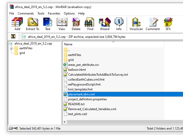
In general, if you want to understand the codes used in a survey you should import the .cep file in the Open Foris Collect survey designer and inspect the survey structure there.

Otherwise, you could also open the .cep file with WinZip/WinRAR (at the end the cep is just a zipped folder) and then open the file called placemark.idm.xml

alt text

permanent link

answered 21 Jan '22, 15:11

Open%20Foris's gravatar image

Open Foris ♦♦
9995714
accept rate: 10%

Thank you very much for taking time to explain it thoroughly, and for directing me toward understanding the codes used in a survey. This helps a lot!

Best, Mary Ann

permanent link

answered 23 Jan '22, 16:08

MaryAnnGeorge's gravatar image

MaryAnnGeorge
112
accept rate: 0%

To complete the answer, here are some (older) videos on :

The installer for Collect can be found here : https://openforis.org/tools/collect/#Download

permanent link

answered 23 Jan '22, 20:20

Open%20Foris's gravatar image

Open Foris ♦♦
9995714
accept rate: 10%

edited 23 Jan '22, 20:21

Your answer
toggle preview

Follow this question

By Email:

Once you sign in you will be able to subscribe for any updates here

By RSS:

Answers

Answers and Comments

Markdown Basics

  • *italic* or _italic_
  • **bold** or __bold__
  • link:[text](http://url.com/ "title")
  • image?![alt text](/path/img.jpg "title")
  • numbered list: 1. Foo 2. Bar
  • to add a line break simply add two spaces to where you would like the new line to be.
  • basic HTML tags are also supported

Question tags:

×281

question asked: 20 Jan '22, 19:49

question was seen: 980 times

last updated: 23 Jan '22, 20:21